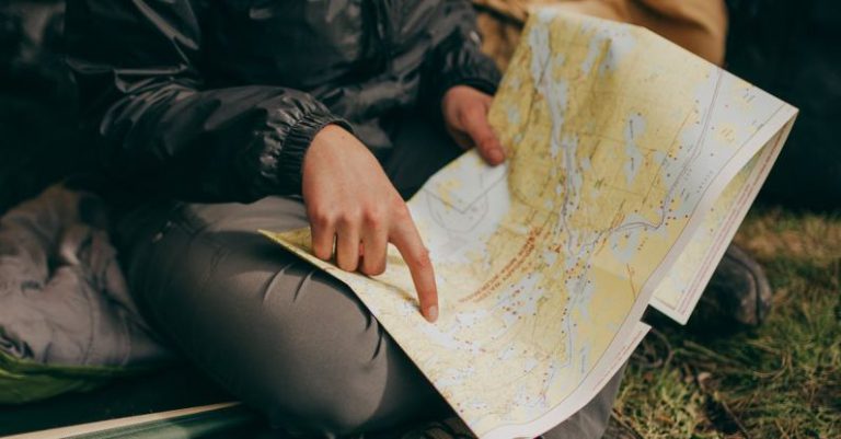
For hikers, having the right map can make all the difference between a successful journey and a frustrating one. Whether you are trekking through a dense forest, climbing a mountain, or exploring a new trail, having a map with key features can enhance your hiking experience and keep you safe. In this article, we will explore the most important map features that every hiker should look for before embarking on an adventure.
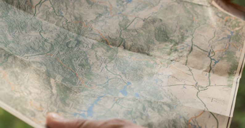
**Topographic Contours**
One of the most crucial map features for hikers is topographic contours. These lines on a map represent changes in elevation and help hikers understand the terrain they will be navigating. By studying the contour lines, hikers can anticipate steep climbs, descents, and overall topography of the area. This information is invaluable for planning a route, estimating the difficulty of the hike, and avoiding potentially dangerous terrain.
**Trail Markers and Symbols**
Trail markers and symbols are essential for hikers to stay on course and navigate their way through the wilderness. These markers indicate trails, junctions, campsites, water sources, and other important points of interest. Understanding these symbols can help hikers identify where they are on the map and make informed decisions about their route. Being able to interpret trail markers will prevent hikers from getting lost and ensure they reach their destination safely.
**Water Sources**
Water is essential for survival, especially when hiking in remote locations. Maps that include water sources such as rivers, lakes, streams, and springs are vital for hikers to plan their hydration strategy and potential camping spots. Knowing the location of water sources can prevent dehydration, ensure access to clean drinking water, and help hikers avoid carrying more water than necessary. Including water sources on a map is crucial for hikers who are venturing into arid or unfamiliar terrain.
**Landmarks and Points of Interest**
Maps that feature landmarks and points of interest provide hikers with valuable reference points to navigate and explore their surroundings. These could include summits, rock formations, lookout points, historic sites, and other unique features that make the hike memorable. Landmarks not only serve as orientation points but also add depth and character to the hiking experience. Hikers can use these landmarks to track their progress, set goals, and appreciate the natural beauty of the area.
**Vegetation and Terrain**
Understanding the vegetation and terrain of an area is essential for hikers to anticipate trail conditions, wildlife encounters, and potential obstacles. Maps that depict vegetation types, such as forests, meadows, and shrublands, can help hikers plan for shade, wildlife habitats, and scenic viewpoints. Additionally, terrain features like cliffs, ridges, valleys, and boulders provide hikers with information on the difficulty level of the hike and possible hazards to watch out for. Having a clear depiction of vegetation and terrain on a map enables hikers to make informed decisions and adapt their route as needed.
**Weather and Safety Information**
Lastly, maps that include weather and safety information are invaluable for hikers preparing for their journey. This could include details on seasonal weather patterns, potential hazards like flash floods or wildfires, emergency contact numbers, and safety tips for outdoor activities. Being aware of weather conditions and safety guidelines can help hikers plan accordingly, pack the necessary gear, and respond effectively to any emergencies that may arise. Prioritizing maps with comprehensive weather and safety information can enhance hikers’ preparedness and confidence during their adventure.
**In Summary**
Choosing a map with the right features is crucial for hikers to have a safe, enjoyable, and successful outdoor experience. From topographic contours and trail markers to water sources and safety information, each map feature plays a vital role in guiding hikers through their journey. By prioritizing maps that include these key features, hikers can navigate with confidence, make informed decisions, and fully immerse themselves in the beauty of the natural world. Next time you plan a hike, remember to equip yourself with a map that encompasses these essential elements to enhance your outdoor adventure.